







Solent Weather Buoy Network
Five real-time stations around the Solent and Chichester Harbour, updated every 5 minutes
The Solentmet Support Group is a small volunteer-run charity that operates five weather and sea-condition stations dotted around the Solent and Chichester Harbour — genuine sensor readings updated on a 5-minute cycle, not a forecast model. Each station reports wind, sea conditions and atmospheric readings separately; use the buttons under each station below to switch between them.
Click a marker to jump to that station below.
The Five Stations
1. Sotonmet
Southampton Dockhead — 50°53.01'N 1°23.66'W
Instrumentation at the VTS Centre building, Southampton Dockhead, about 53m up — clear of any interference from surrounding buildings.

2. Bramblemet
Bramble Bank, central Solent — 50°47.41'N 1°17.15'W
On the Bramble Pile, roughly equidistant from Cowes, Calshot and Hill Head — the oldest station in the network, set up in 2004 with the RNLI.

3. Chimet
Hayling Bay — 50°45.45'N 0°56.59'W
On West Pole Beacon, about a mile out to sea from the entrance to Chichester Harbour.
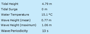
4. Cambermet
Chichester Harbour — 50°47.84'N 0°53.97'W
On Camber Pile, about half a mile off the entrance to the Thorney Channel.
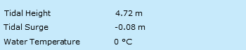
5. Emsmet
Emsworth Channel / Sweare Deep — 50°49.73'N 0°56.78'W
The newest station in the network, installed for Emsworth Sailing Club in 2024/25 to cover a busy stretch of the harbour the older stations don’t reach.
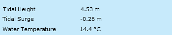
Source: Solentmet Support Group — Bramblemet, Sotonmet, Chimet, Cambermet & Emsmet — see Credits for full details.
See also: UK Wave Height • UK Buoy Data • Solent & Dorset Beach Forecast • Local Tides