








Cloud Spotting Guide
Clouds tell a weather story before the forecast catches up with it — a thickening veil of cirrostratus a day ahead of rain, or a sky full of harmless fair-weather cumulus that will burn off by lunchtime. This guide covers the ten basic cloud types recognised worldwide under the World Meteorological Organization's International Cloud Atlas, grouped by the height band they're normally found in.
Typical Height Range by Cloud Type
Approximate base-to-top height ranges above the UK. Cumulonimbus is the exception — a single storm cloud can span the entire atmosphere from low cloud base to the tropopause.
High-Level Clouds — roughly 6,500m (20,000ft) and above
Thin and pale, almost always made of ice crystals rather than water droplets because of how cold it is at this altitude. They're the first clouds to catch the colour at sunrise and sunset, and often the first visible sign of a warm front still a day or more away.
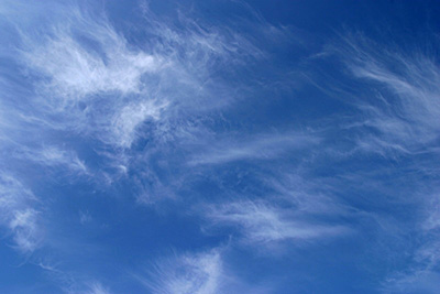
Cirrus (Ci)
Latin: cirrus, "a curl of hair"
Delicate, detached white filaments or narrow bands, often with a silky or fibrous sheen. Made entirely of ice crystals, which is why they rarely dim the sun even when fairly extensive.
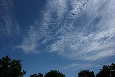
Cirrocumulus (Cc)
Latin: cirrus + cumulus
A thin, white, patchy sheet of small ripples or grains with no shading, each element narrower than a little finger held at arm's length. Short-lived, and usually forms from cirrus or cirrostratus breaking up.
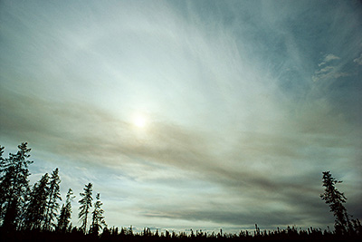
Cirrostratus (Cs)
Latin: cirrus + stratus
A transparent, whitish veil, fibrous or smooth, that can cover the entire sky without ever fully blotting out the sun. The giveaway sign is a halo around the sun or moon, caused by light refracting through the ice crystals.
Mid-Level Clouds — roughly 2,000-6,500m (6,500-20,000ft)
Made mostly of water droplets, sometimes ice at the colder end of the range. Confusingly named with the Latin prefix "alto" (meaning high) even though they sit in the middle band — the name exists simply to distinguish them from their low-level look-alikes, stratus and cumulus.
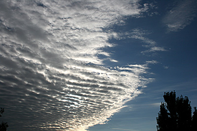
Altocumulus (Ac)
Latin: altus + cumulus
White or grey patches, sheets or rolls, each element between one and five finger-widths at arm's length — noticeably bigger than cirrocumulus. The most common mid-level cloud, often appearing in several layers at once.
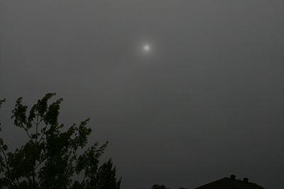
Altostratus (As)
Latin: altus + stratus
A grey or bluish sheet, thin enough that the sun still shows through as if seen through ground glass, but without the halo effect that marks out cirrostratus.
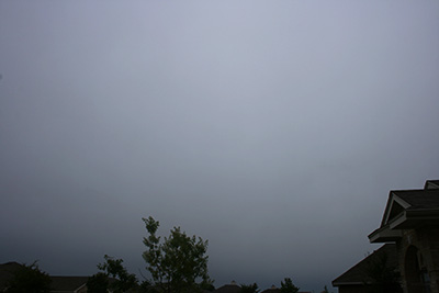
Nimbostratus (Ns)
Latin: nimbus + stratus, "rain cloud"
A thick, dark grey layer that fully blots out the sun, usually already producing steady rain or snow by the time it's overhead. Its base often lowers further as precipitation continues, which is why it's easy to mistake for a low cloud even though it starts in the mid-level band.
Low-Level Clouds — surface up to roughly 2,000m (6,500ft)
Made of water droplets, and the clouds people notice most because they're closest to the ground. One member of this group, cumulonimbus, is the exception that breaks every rule — its base sits low but its top can punch straight through the mid and high levels into the stratosphere.
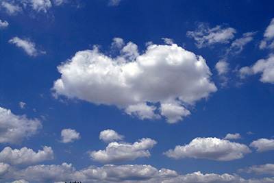
Cumulus (Cu)
Latin: cumulus, "a heap"
Detached, sharp-edged heaps with flat, dark bases and brilliant white, cauliflower-like tops. The classic "fair weather cloud", forming through the morning as the ground heats up and mostly dissolving again by evening.
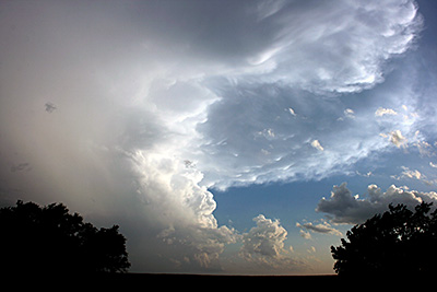
Cumulonimbus (Cb)
Latin: cumulus + nimbus
The thunderstorm cloud: a huge, dense tower with a smooth or fibrous top, very often flattened into the classic anvil shape where it hits the tropopause and can rise no further. Produces heavy rain, hail, lightning and, occasionally, tornadoes.
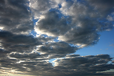
Stratocumulus (Sc)
Latin: stratus + cumulus
Grey or whitish patches, sheets or rolls with a honeycomb-like or tessellated appearance, each element wider than three finger-widths at arm's length — noticeably bigger than altocumulus.
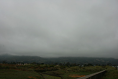
Stratus (St)
Latin: stratus, "a layer"
A uniform, featureless grey layer with a flat base, often sitting almost at ground level. When the sun shows through, its outline is clearly visible, unlike the diffuse glow through nimbostratus.
Quick Reference Table
| Cloud | Code | Height Band | Made Of | Typical Signal |
|---|---|---|---|---|
| Cirrus | Ci | High | Ice | Fair weather now, front possibly a day out |
| Cirrocumulus | Cc | High | Ice | "Mackerel sky" — change coming |
| Cirrostratus | Cs | High | Ice | Rain within 24 hours (haloed sun/moon) |
| Altocumulus | Ac | Mid | Water/ice | Possible storms later if building fast |
| Altostratus | As | Mid | Water/ice | Rain within several hours |
| Nimbostratus | Ns | Mid (base can lower) | Water/ice | Steady rain in progress |
| Cumulus | Cu | Low | Water | Fair weather; watch for growth |
| Cumulonimbus | Cb | Low base, top to high | Water/ice | Thunderstorm, active now |
| Stratocumulus | Sc | Low | Water | Dull skies, little rain |
| Stratus | St | Low | Water | Fog/mist, may just be low cloud |
Cloud Spotting Around Southampton
The Solent's coastal position makes stratus and shallow stratocumulus especially common here — overnight radiation fog frequently lifts into a low stratus deck rather than clearing completely, particularly in autumn and winter when the sea is still relatively mild compared with cooling land air. Towering cumulus and the odd cumulonimbus are more of a spring and summer feature, often arriving on a south-westerly airflow after a spell of humid, unstable weather. For the live picture right now, our satellite imagery pages show the cloud actually overhead.